Selected photos from the Danish countryside and Copenhagen
Selected photos from the Danish countryside and Copenhagen
Text & photos: Erik Pontoppidan
Copyright: Erik Pontoppidan
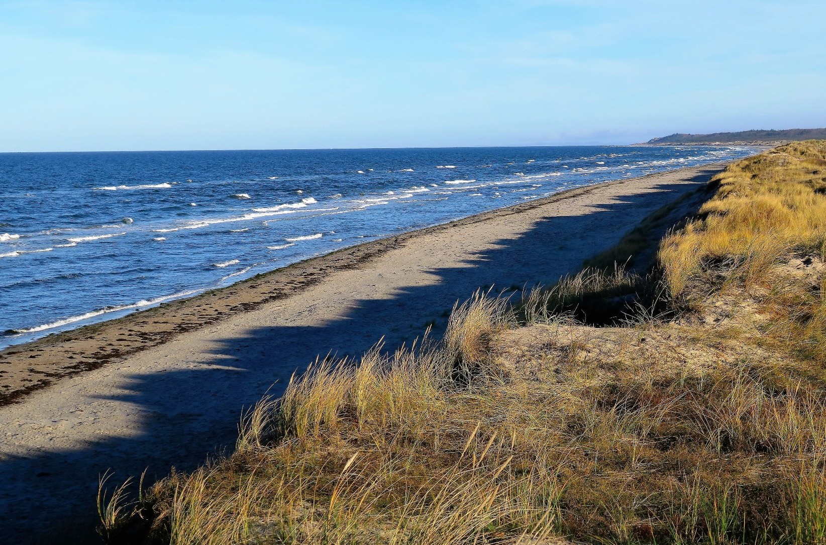
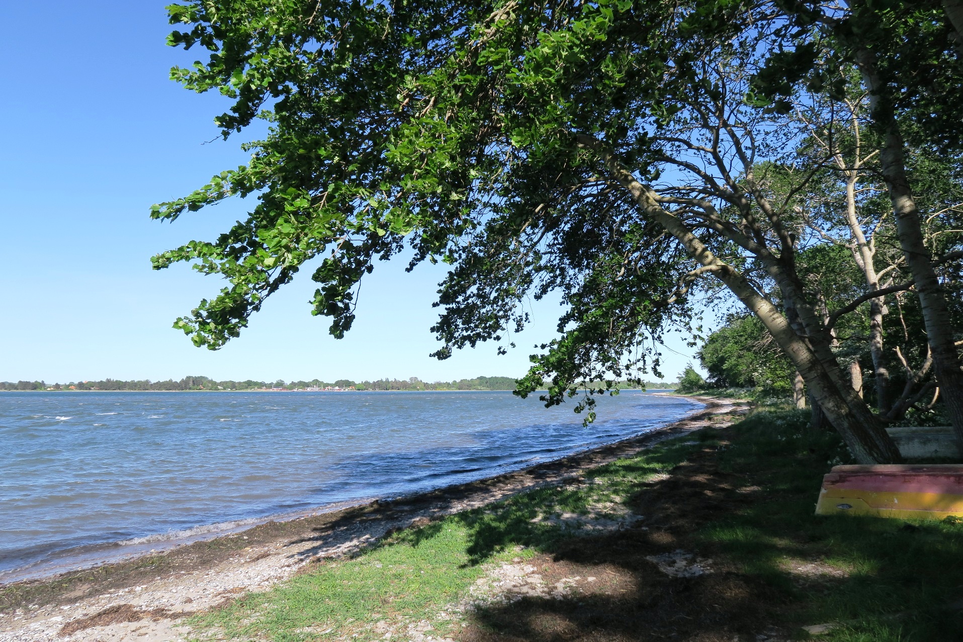
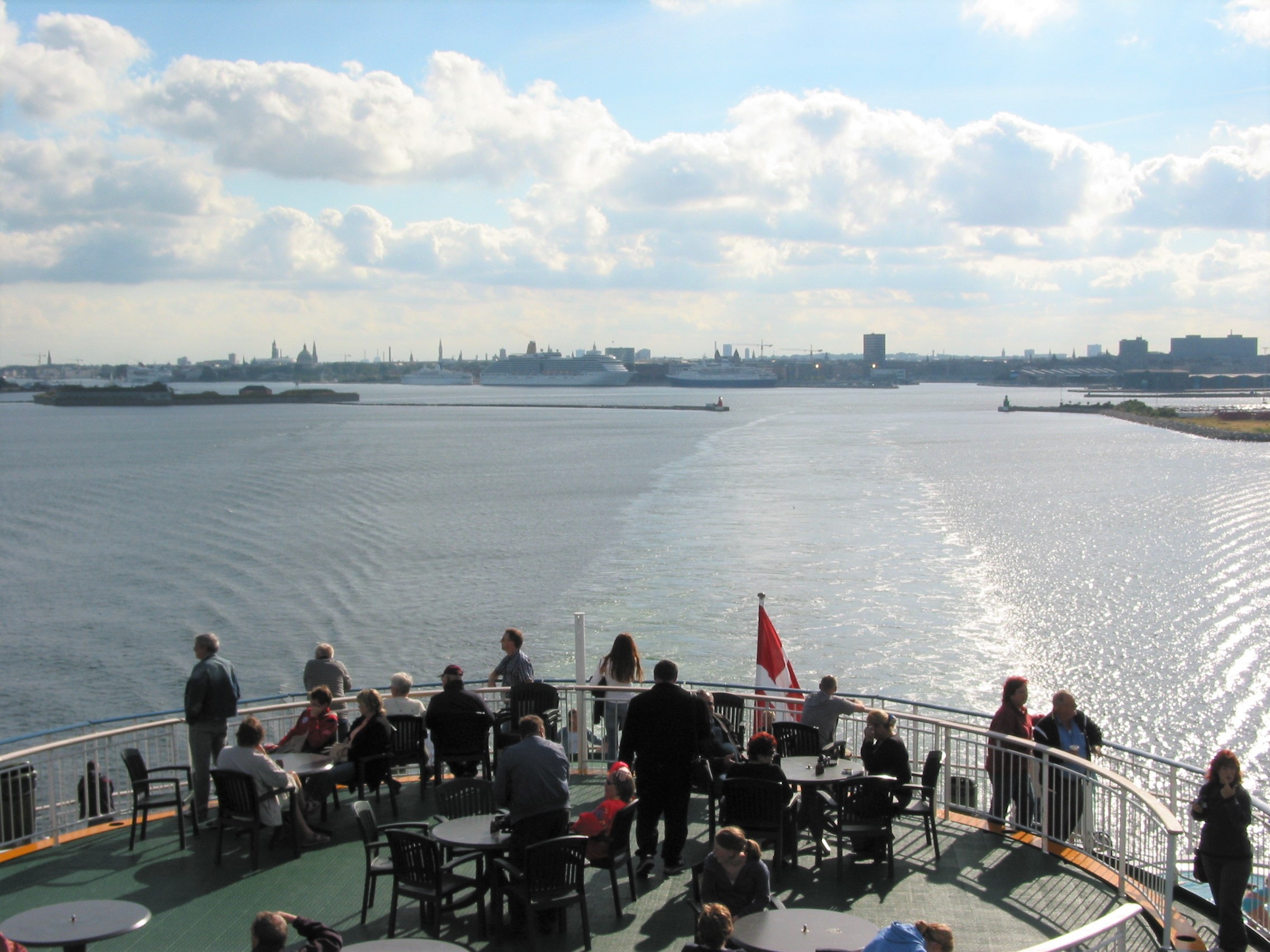
Denmark is a land of coastlines. No matter where you are in the country, the distance to the sea is short, and the chances of sea-views are pretty fair. There are thousands of kilometres of sandy, stony, quiet and evocative shores. And the abundance of fjords, islands and beaches is very attractive to foreign tourists, especially if their homeland is in the middle of a continent. In fact, the sea with its infinite horizon impresses the continental tourist in the same way as the high mountains attract the Danes.
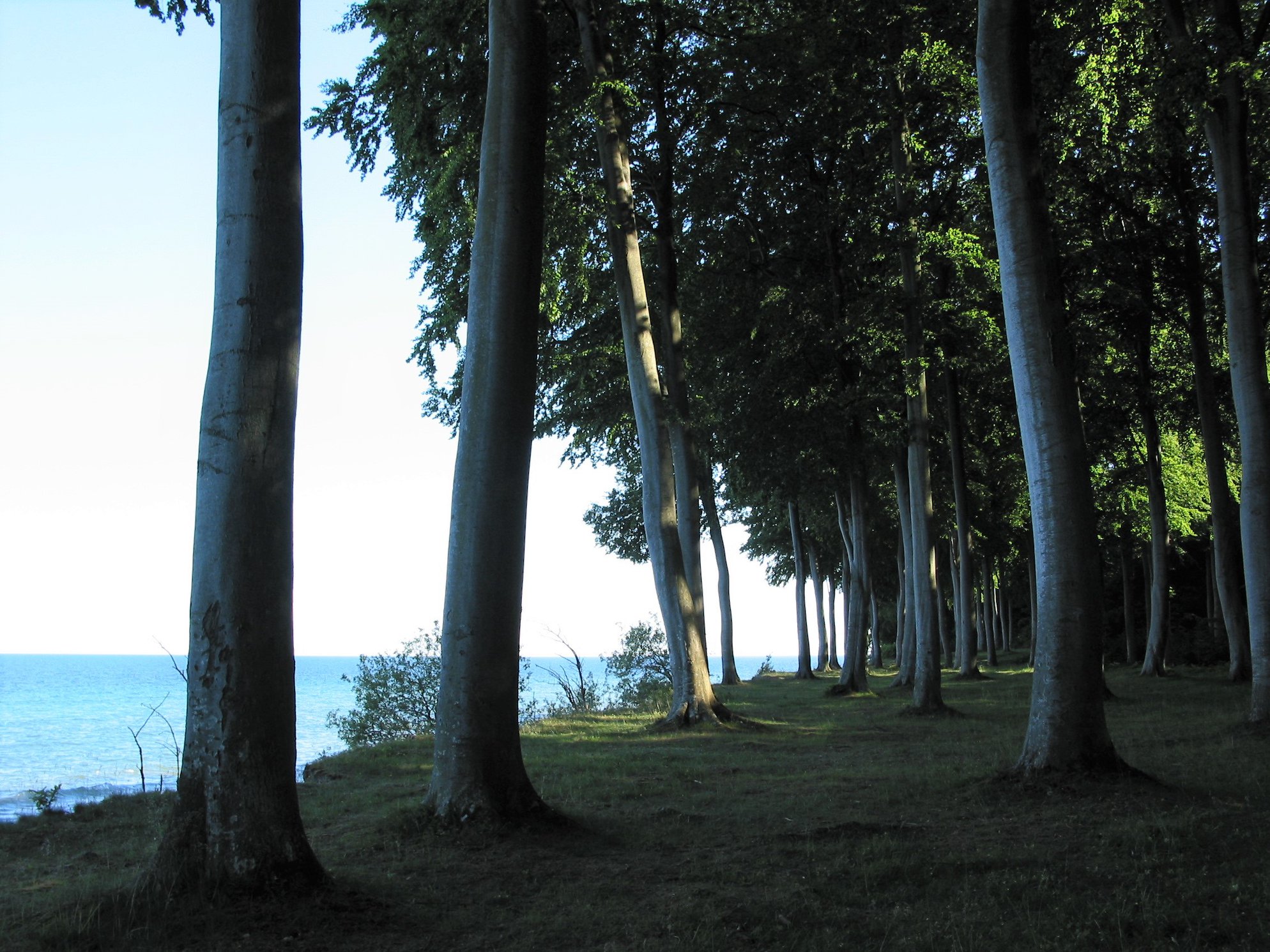
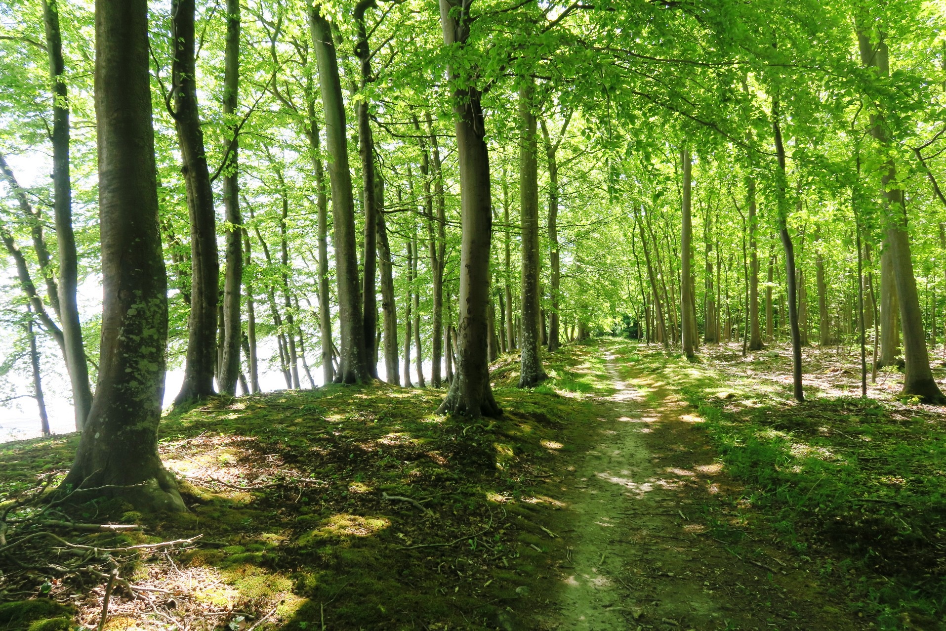
The most popular beaches are those with plenty of sand and dunes. Other coastlines - especially in southern Denmark - are framed by dense beech forests bordering on the sandy or stony coasts - a landscape, which has inspired several famous Danish poets. Walking in these areas is one of the most rewarding nature experiences you can get in my country.
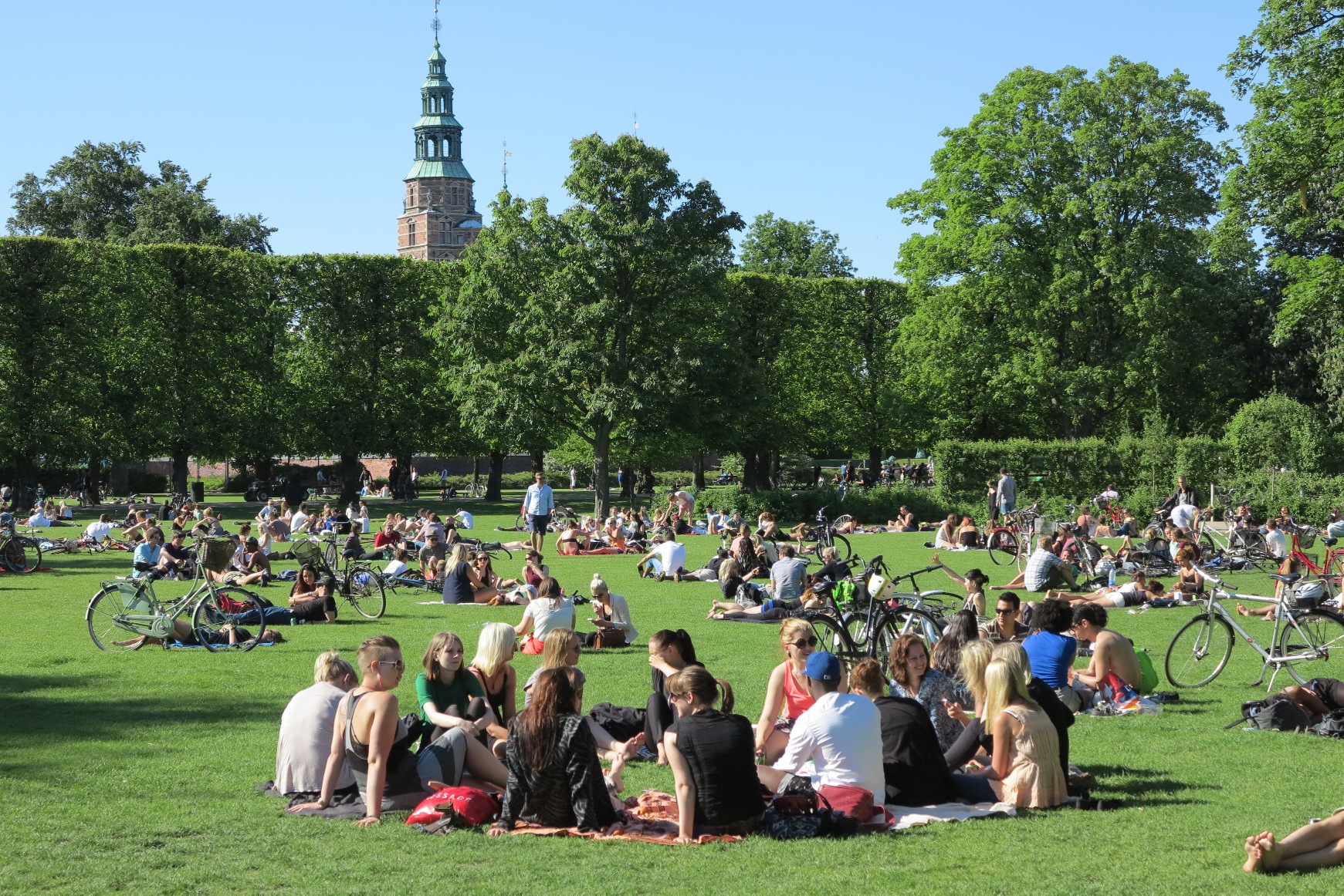
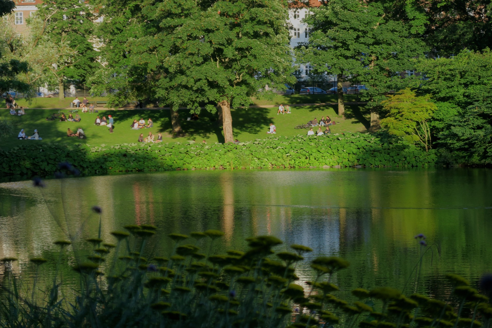
From a climatic point of view, Denmark is a land of contrasts. The Danish winter is long, dark, wet and humid. But when the first signs of spring appear in March or April, everybody wakes up and crowds in the outdoor cafés, the parks and the countryside. And everybody loves the warm and dry periods in summer, with the long, bright nights and the fresh and green vegetation.
So far, most of the photos on this page are concentrated on the following areas in Denmark:
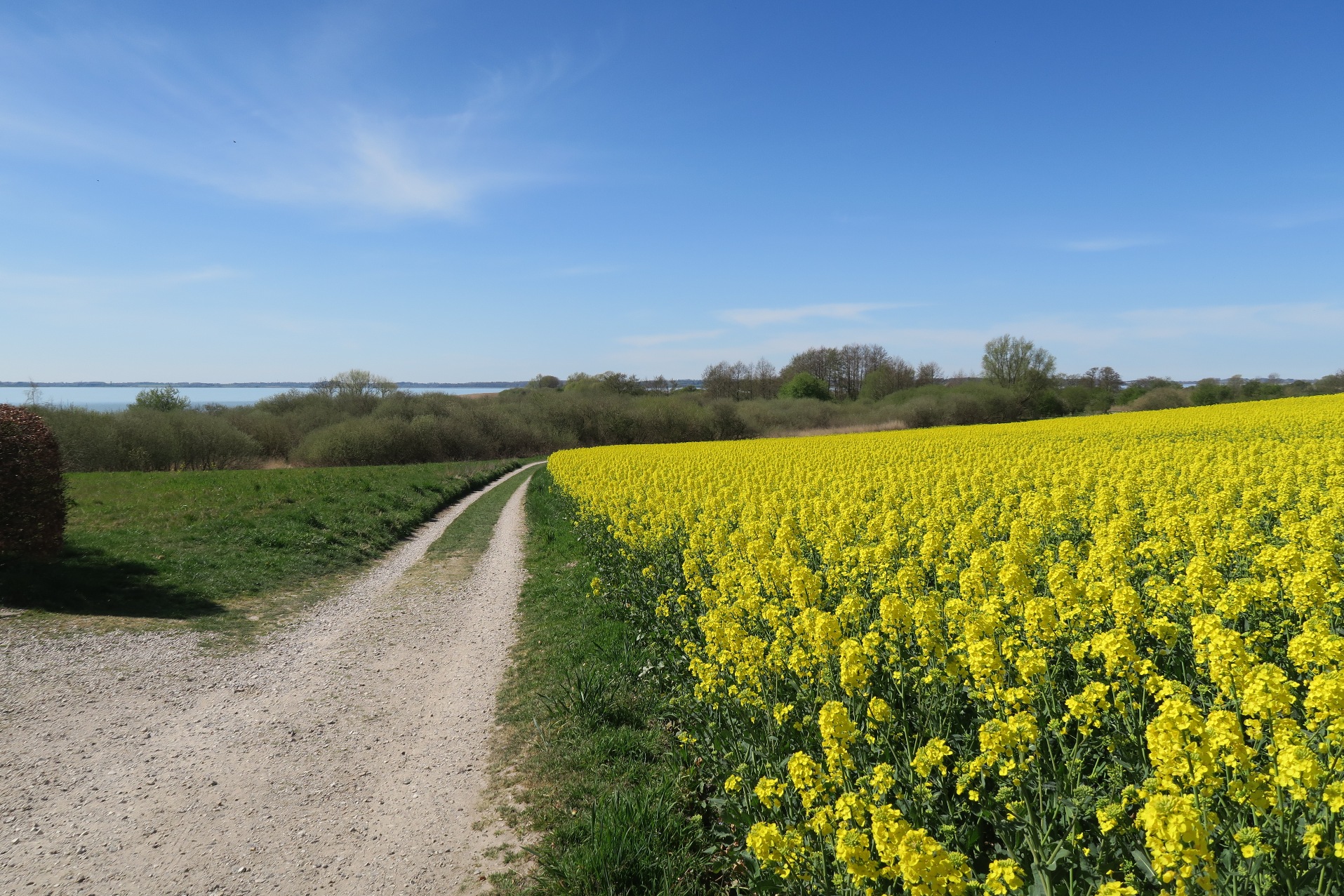
The northern Zealand close to the Kattegat Sea, which is my place of residence today.
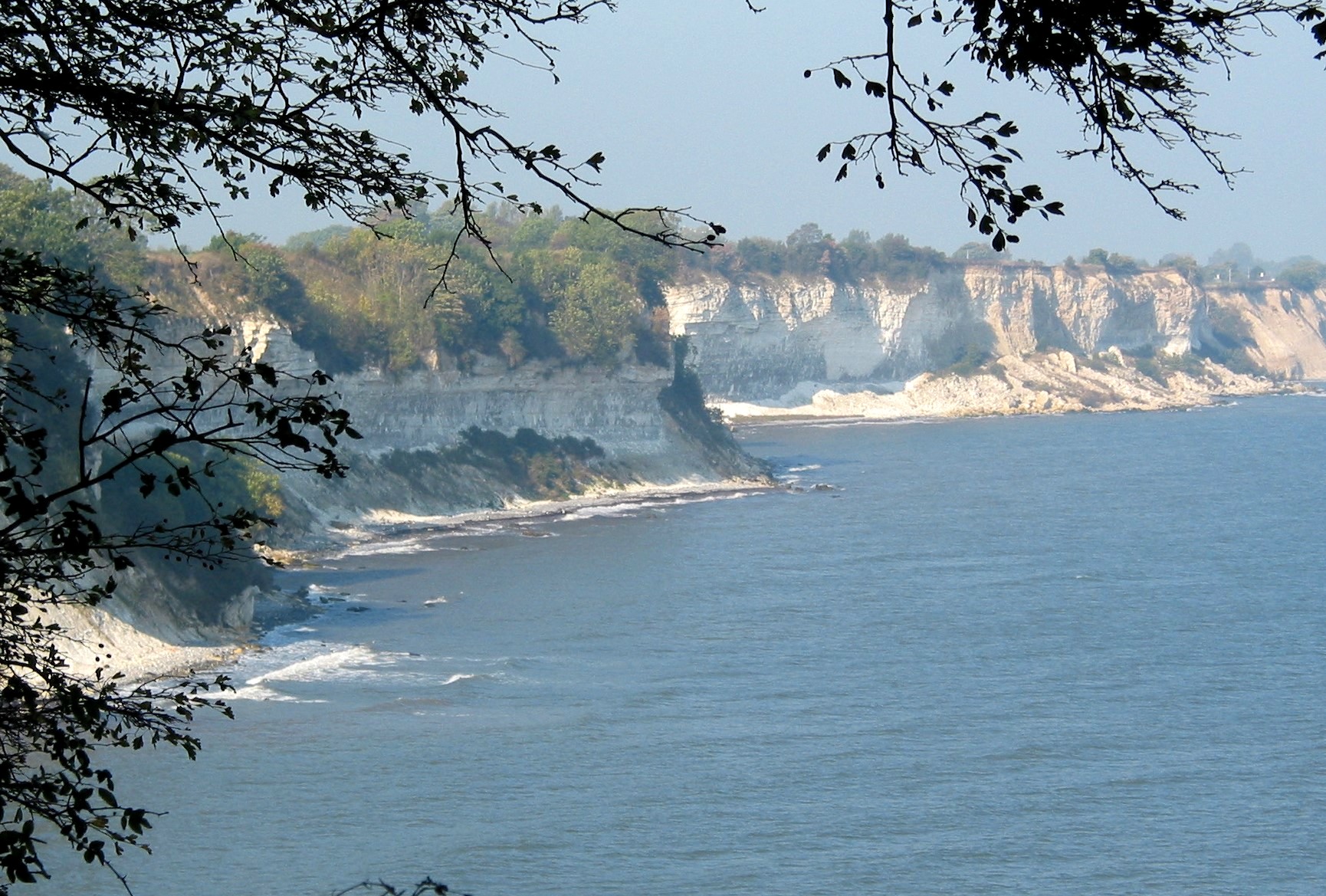
The island of Mřn in southern Denmark, where I lived with my grandparents for long periods during my childhood.
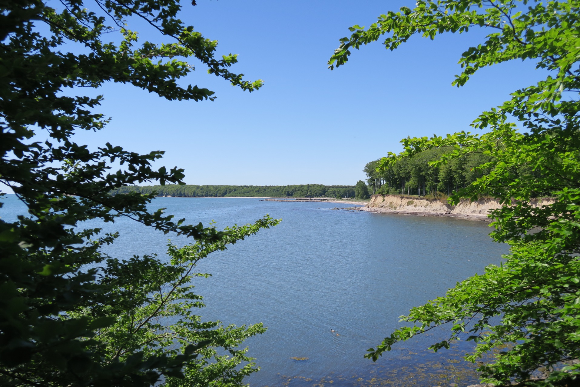
The island of Falster in southern Denmark, with breath-taking landscapes at lonely coasts shores framed by green beech forests.
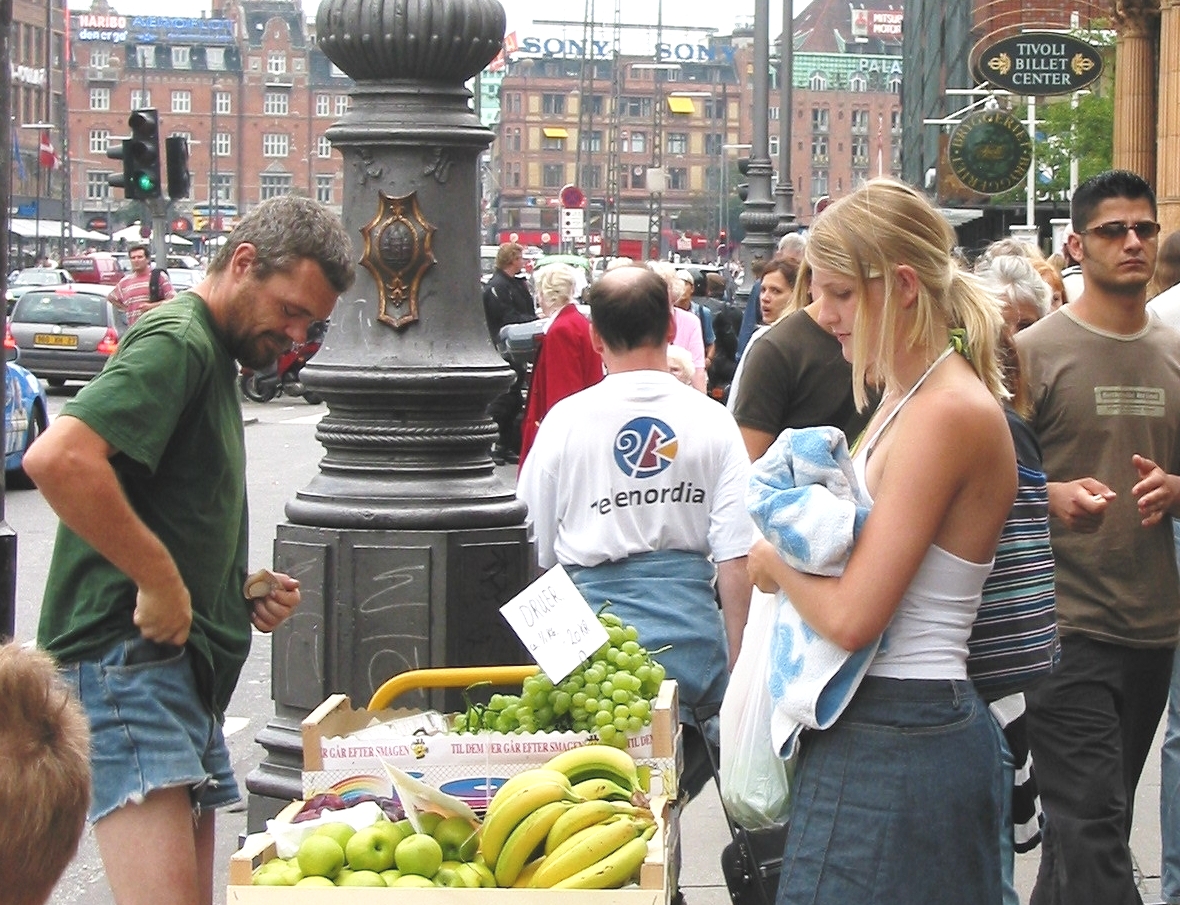
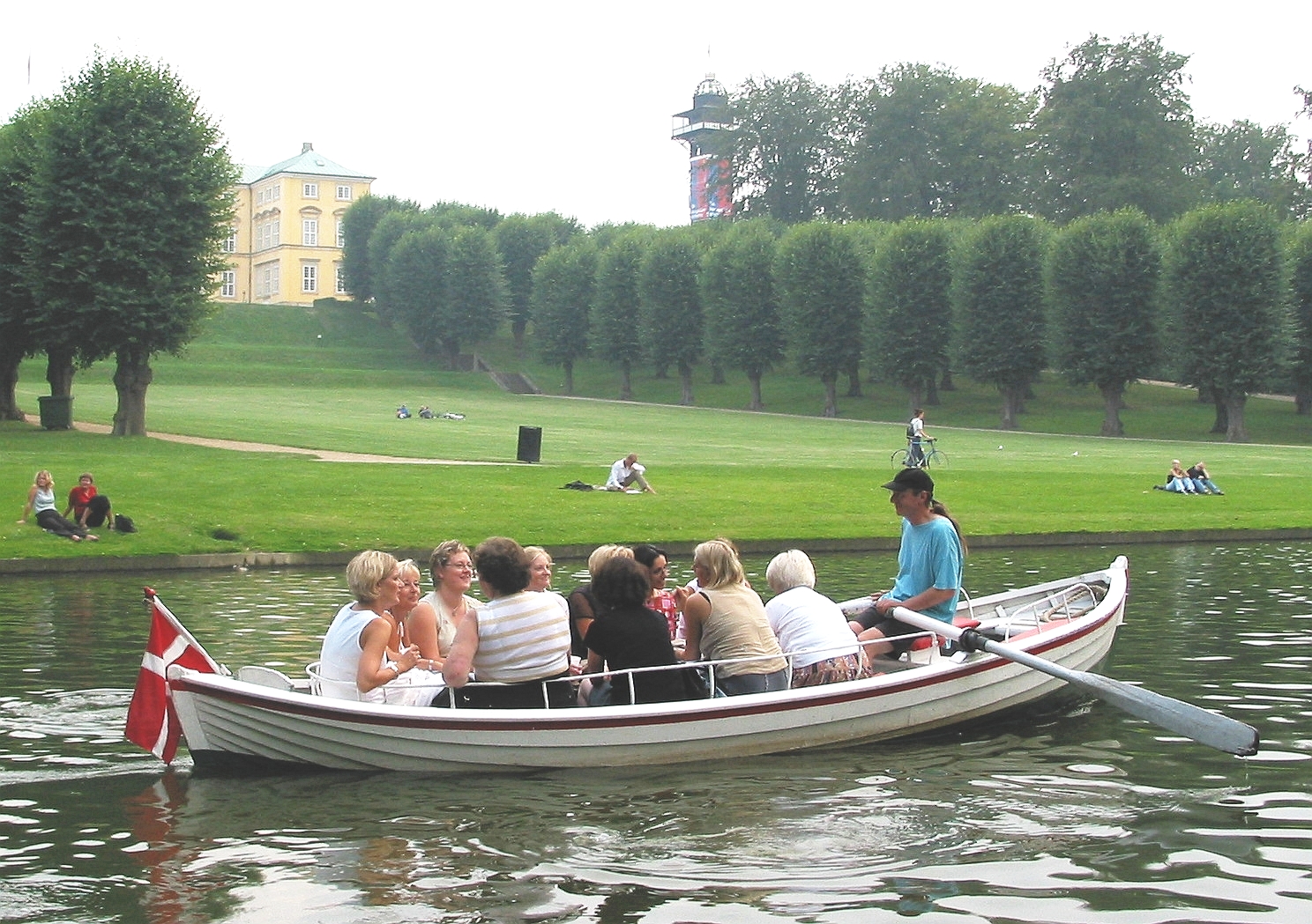
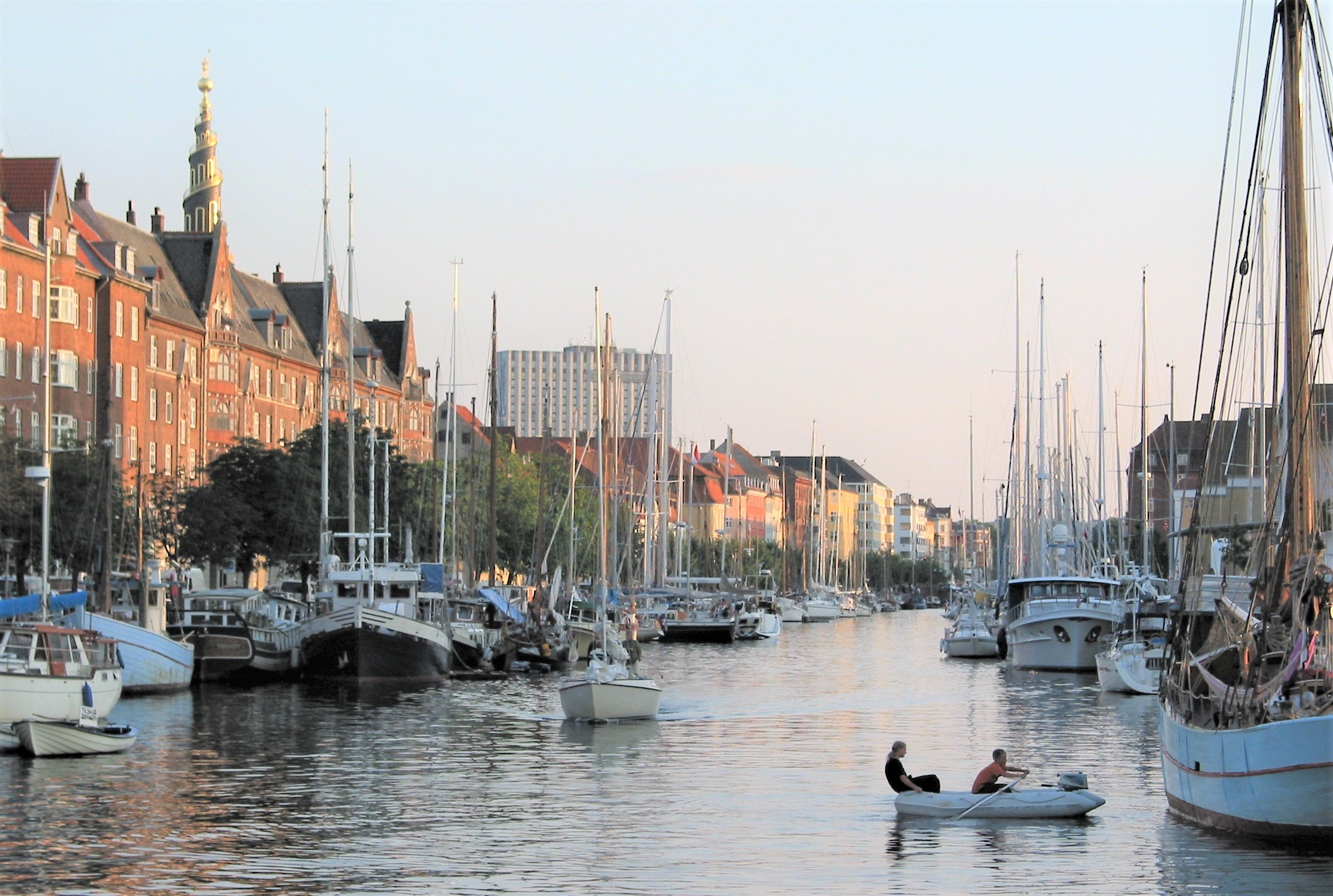
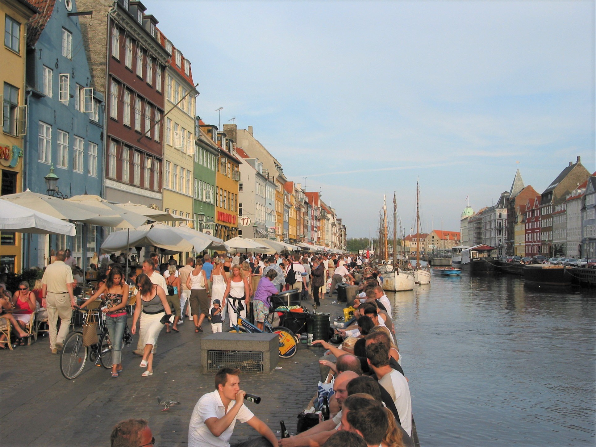
Copenhagen, the capital of Denmark. I was born in Frederiksberg in central Copenhagen and have been living in the city for about 30 years.
I hope that my photos will explain some of my enthusiasm.
Below: Photos from Northern Zealand.
Click or push on the photos for max size and detailed information.
Below: Photos from the island Mřn in southern Denmark.
Click or push on the photos for max size and detailed information.
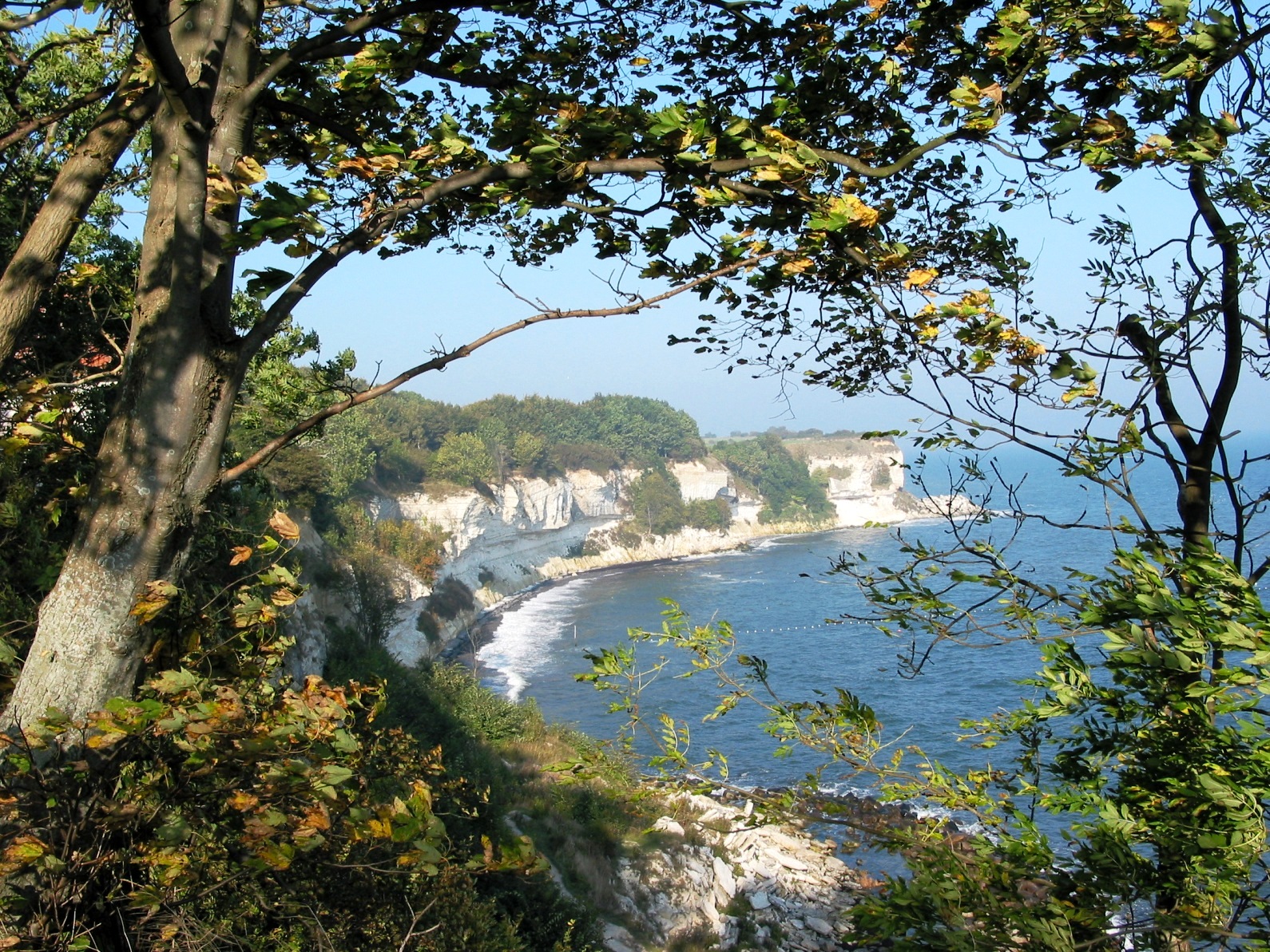
Mřn can show you all aspects of Danish landscapes. And in my opinion, Mřns Klint is the most impressive nature area in Denmark. A hike along the white chalk cliffs at The Baltic Sea on Eastern Mřn is a unique experience at all seasons. The impressive views, the sound of the waves along the beach, which is reflected from the high cliffs with a geology close to the age of the dinosaurs - everything is special and fantastic. And Western Mřn is the epitome of classic Danish nature at its finest. Walk in direction south-east from Hĺrbřlle Harbour along Grřnsund, which is the narrow sound separating Falster and Mřn. Suddenly, you are standing on the shores of The Baltic Sea with no signs of land in the horizon. And if you continue your walk along the deserted coast, you reach Fanefjord Forest - a locality known only by the few, with the beech trees rising along the beach. Sit down here under the tall beech trees and listen to the sound of the waves pushing the flintstones. During thousands of years, the waves have pushed the flintstones to this place all the way from Mřns Klint, where they have been washed out from the white chalk cliffs. Yes, Mřn is fantastic!
Below: Photos from the island Falster in southern Denmark.
Click or push on the photos for max size and detailed information.
In late May 2020, I went for one of my favorite walks in the beech forest along the coast of northern Falster. Approximately 11 kilometers of hiking along Grřnsund and the Baltic Sea from the former ferry site at Grřnsund between the islands Falster and Moen in the 1700s, and to Hesnćs. It is a fantastic area. In fact, there are not many places in Denmark where the beech forest grows right out to the beach.
At the staring place of my walk, you find the place of the old ferry site at Grřnsund, where the famous Danish woman Marie Grubbe (app. 1643-1718) ended her life as a poor ferry wife. She was married three times during which she experienced every step of the social ladder. Her first marriage was as a 17-year-old girl in 1660, when she married King Frederik the third illegitimate son Ulrik Frederik Gyldenlřve.
In her last 13 years, Marie Grubbe lived in Borrehuset by Grřnsund, which also served as an inn, where she was married to a drunk and violent ferryman. But she started her life as a Danish nobility wife, and her unusual destiny has captivated historians, writers and readers since the 18th century. She is featured by H.C. Andersen and Steen Steensen Blicher, and J.P. Jacobsen wrote a Danish novel about her in 1876 ("Fru Marie Grubbe"), which is considered as one of his major works. Jacobsen's novel is a literary interpretation of her life, and it was included in the Danish cultural canon in 2005.
Ludvig Holberg himself (famous Danish writer, 1684-1754) lodged in Borrehuset in 1711 during the plague in Copenhagen, and he later wrote about Marie Grubbe in his Epistle 89 - "Om mćrkelige Ćgteskaber" ("About Strange Marriages"), in 1748. Today there is a very special karma in the area, where Borrehuset has been.
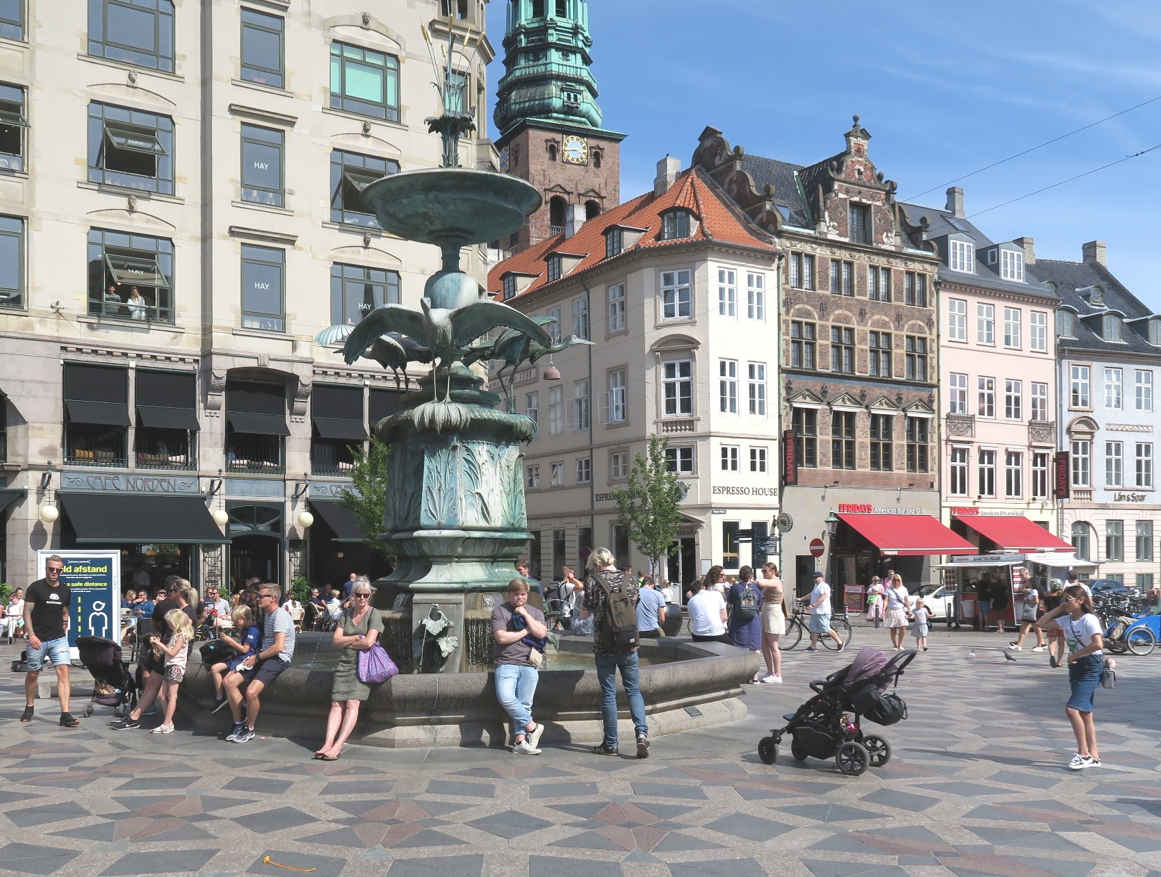
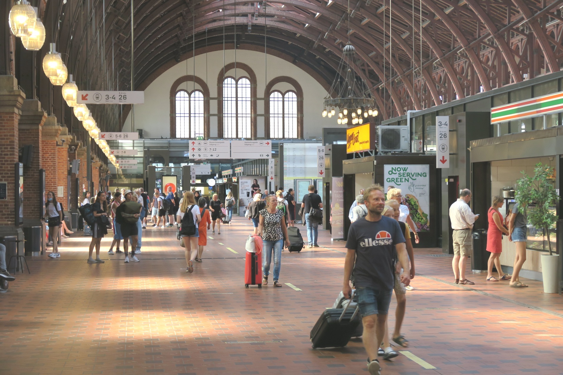
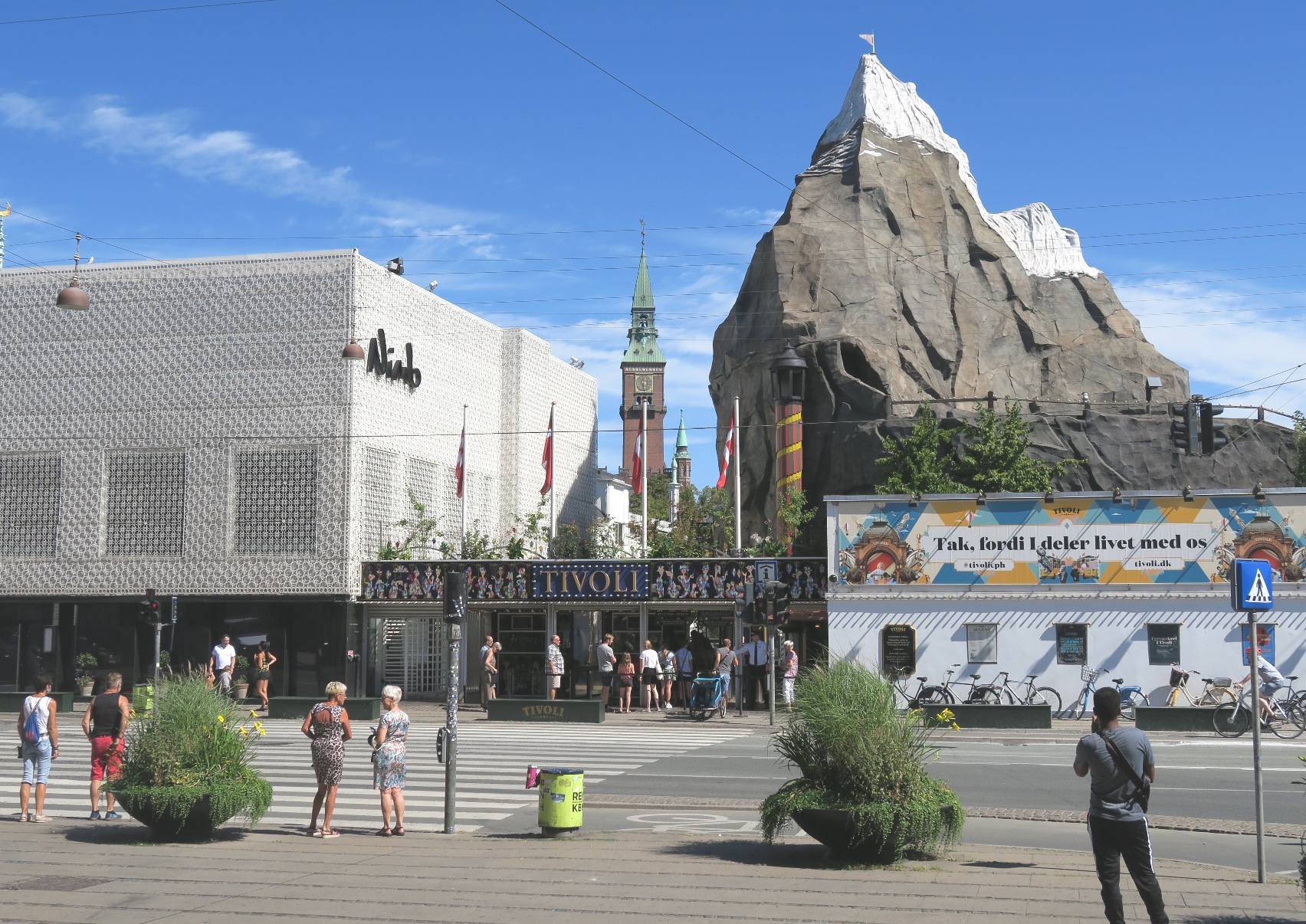
Below: Photos from Copenhagen.
Click or push on the photos for max size and detailed information.
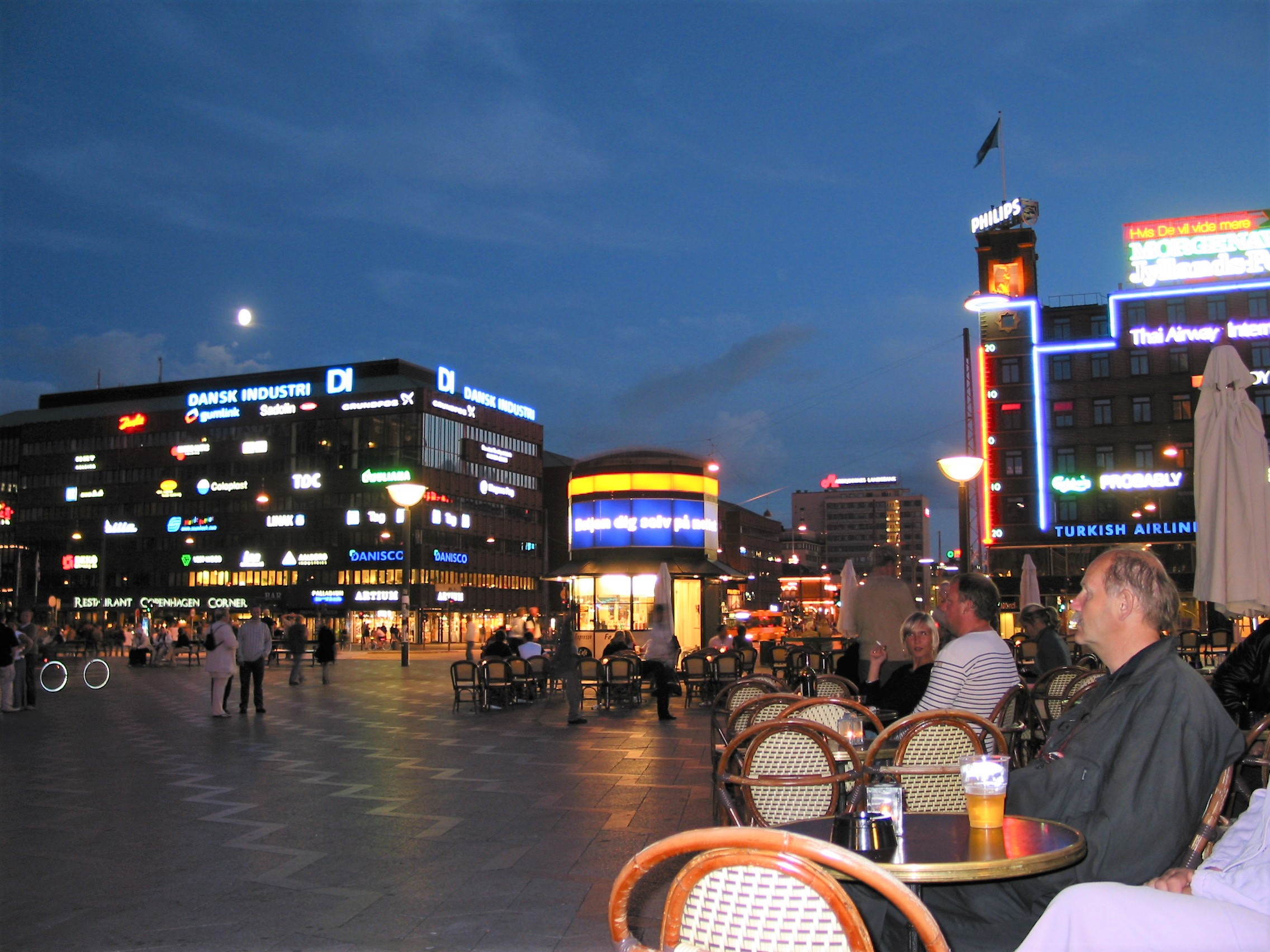
The best way to see Copenhagen is on foot or on bicycle during the summer months. In this way, the town will reveal some of its most charming aspects to you: The beautiful location close to the sea, the long, bright nights, the numerous historical buildings with an exciting past, the flourishing cafés and restaurants, the colorful parts of the town with an exotic and ethnic atmosphere, the refreshing green parks. And even incarnated Copenhageners never get tired of visiting Tivoli, placed in the city center and known as one of the world's most beautiful amusement parks.
I have been staying most of my life in Copenhagen, and I am proud of my city. I hope this page will explain some of my enthusiasm.
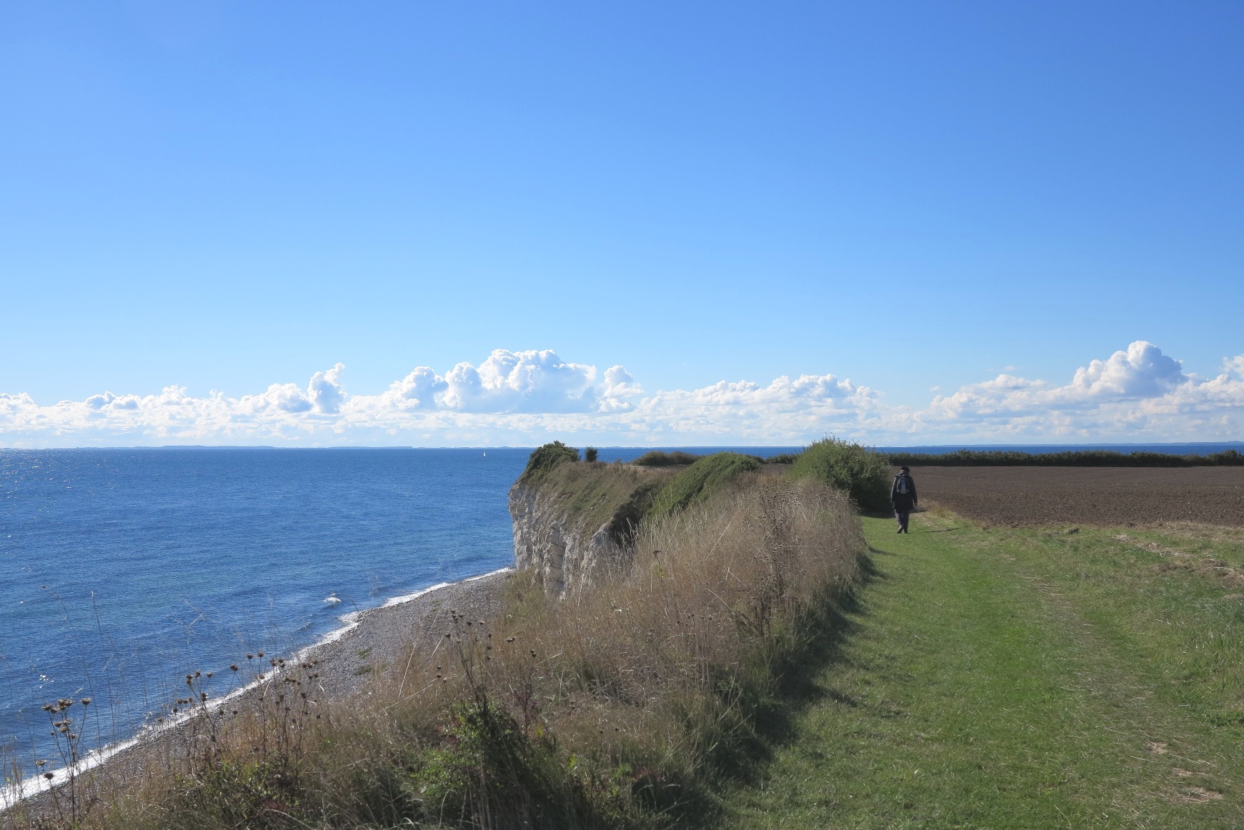
Below: Photos from Stevns Klint on Western Zealand.
Click or push on the photos for max size.
Since the summer 2005, a hiking trail of approximately 21 kilometers of fantastic scenery between Gjordslev Břgeskov and Rřdvig on the Stevns peninsula has been opened to walkers and nature enthusiasts along the very beautiful and dramatic coastline on Stevns.
Most of the way you walk on the top of the cliff. I have walked along the trail many times - alone or with friends or girlfriends - and each time, I have returned with a great mental surplus.
The incredible story about Stevns Klint and the dinosaurs
Why were the dinosaurs and half of all animal species extincted 65.5 million years ago? That's a question many scientists have tried to answer.
In the 1970s it was known, that at the time when the dinosaurs were extincted, a strange clay layer was deposited, and that this clay layer could be seen all around the Earth. The clay layer lacked any signs of life and thus indicated, that life on Earth had almost stopped for quite a long time.
Two American scientists, father and son, set out to find out how long this strange period had lasted. The son is geologist Walter Alvarez, and the father was a Nobel laureate in physics, Louis Alvarez.
Their theory was, that because we know how much dust from space lands on Earth each year, it was possible to measure the content of dust and calculate how long it had taken to deposit the clay layer. They chose to measure on the element iridium, which is rare on Earth but common in material from space.
First they measured how much iridium was in the clay layer in Italy. And then they were surprised. There was much more than expected. The second step was to investigate whether it was just something that had happened in Italy or if it had happened all over the Earth. And that is why Walter Alvarez visited Stevns Klint in 1978 and took a sample of the clay layer.
The test showed, that there was approx. 60 times more iridium in the fish clay layer than expected. The conclusion was, that 65.5 million years ago, the Earth was hit by a large amount of material from space - an asteroid. A crucial piece in the mystery of the extinction of dinosaurs was found.
The crater on the Yucatan Peninsula
In 1991, traces of a 200-kilometer-wide crater were found on the Yucatan Peninsula of Mexico, matching the time of the dinosaurs' extinction. Since that time, the hypothesis of an asteroid impact has become increasingly accepted within the research world. The asteroid has been named the Chicxulub meteor after the village located on the place of the crater today.
Studies have shown, that the event took place in the latter part of the Cretaceous period approx. 65.5 million years ago, and it was so violent, that it caused a mass death on Earth. The asteroid is estimated to have been about 10 km in diameter. The impact caused huge tsunamis, which moved in all directions. Dust and other particles reached high into the atmosphere, shutting off the sunlight. From 2016, researchers have begun to investigate the crater by drilling tests.
Click or push
HERE to check out the main entrance to the English version of my home page, with exciting links to travelling and trekking.